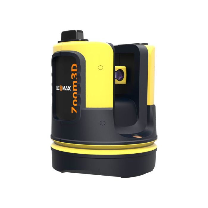
GeoMax 3D System Indoor Outdoor 3d Scanner
With very simple configuration and equipped with an auto levelling feature, the Zoom3D is a plug-and-play solution that speeds up your daily tasks.
Its user-fiendly onboard software helps with a wide range of indoor applications such as measuring, setting out or plumbing points. Levelling can now be completed with greater ease and speed, then exported in most common file formats.
For your outdoor tasks, the Micro Robotic solution is equipped with target recognition technology that automatically and easily centres and follows the target, allowing surveys and stakeouts in small construction sites.
PLUG AND PLAY SOLUTION
- Simple configuration
- Auto levelling feature
- Powerful 7“ Windows tablet
MICRO ROBOTIC SYSTEM
- Target recognition technology
- Auto targeting and tracking functions
- Ideal for small construction sites
YOUR INDOOR PARTNER
- Highly accurate 3D measurements
- User friendly onboard software
- Full set of applications and easy data Export
GeoMax Zoom3D Basic
- Zoom3D in Carry Case
- Control Unit
- Power Supply
- 2 USB cable
- Power Cable
- RM100 Remote Control
- USB Stick, ext Wi-fi usb stick
- Data CD
- Safety Manual
- Quick Start
- CE + Producer Certificate
- X-PAD 3D Base
GeoMax Zoom3D Robotic
- Zoom3D in Carry Case
- Control Unit
- Power Supply
- 2 USB cable
- Power Cable
- RM100 Remote Control
- USB Stick, ext Wi-fi usb stick
- Data CD
- Safety Manual
- Quick Start
- CE + Producer Certificate
- X-PAD 3D Base
- X-PAD 3D "Robotic module" (option)
- Target Kit and Holder for Tablet
- ZPT101 Alu telescopic pole with stub for TPS, extends to 2.15m, yellow
| GONIOMETER | |
| Measurement range | Horizontal 360°; vertical 250° |
| Accuracy | 5˝, equates to 1.2 mm @ 50 m |
| LASER DISTANCE METER | |
| Type | Coaxial, visible red laser |
| Measurement range | 0.5 - 50 m |
| Laser class | 2 |
| Laser type | 650nm; < 1mW |
| ø laser dot (at distance) | 10 m: ~7 mm ×7 mm |
| 30 m: ~9 mm ×15mm | |
| TIE DISTANCE ACCURACY (3D) | |
| Angle and distance | @10 m @30 m @50 m |
| combination | Approx. 1 mm 2 mm 4 mm |
| TILT SENSOR | |
| Self-levelling range | ±3° |
| Accuracy | 10˝, equates to 2.5 mm @ 50 m |
| DIGITAL POINT FINDER | |
| Zoom (magnification) / | 1× / 3.40 m × 2.14 m |
| Field of view (@ 10 m) | 2× / 1.70 m × 1.07 m |
| 4× / 0.85 m × 0.54 m | |
| 8× / 0.42 m × 0.27 m | |
| CIRCULAR LEVEL SETTING | |
| Accuracy | 1°/mm |
| OPERATION | |
| Keys/user interface | 1 on /off button |
| Interfaces | USB type B, power supply power pack |
| COMMUNICATION | |
| Cable | USB: Micro-B USB and type a; WLAN |
| Wireless | 50m range ** |
| POWER SUPPLY | |
| Internal battery | Li-Ion battery 14.4 V / 63 Wh |
| External power | 24 VDC / 2.5A, charging time 8 h |
| Operating time | 8 h |
| PHYSICAL SPECIFICATIONS | |
| Dimensions | Height 215.5 mm, ø 186.6 mm |
| Weight | 2.8 kg |
| Operating temp. | – 10°C to 50°C |
| Storage temp. | – 25°C to 70°C |
| Protection class | IP54 (IEC 60529) |
| Attachment | 5 ⁄ 8” thread |
| REMOTE CONTROL | |
| Range | 50 m ** |
| Communication | Infrared (IR) |
| Battery | 1 AA, 1.5 V |
* Accuracy is specified at 20°C
** Depending on environment.
| Manufacturer | Geomax |
|---|---|
| Includes | GeoMax Zoom3D Basic
GeoMax Zoom3D Robotic
|