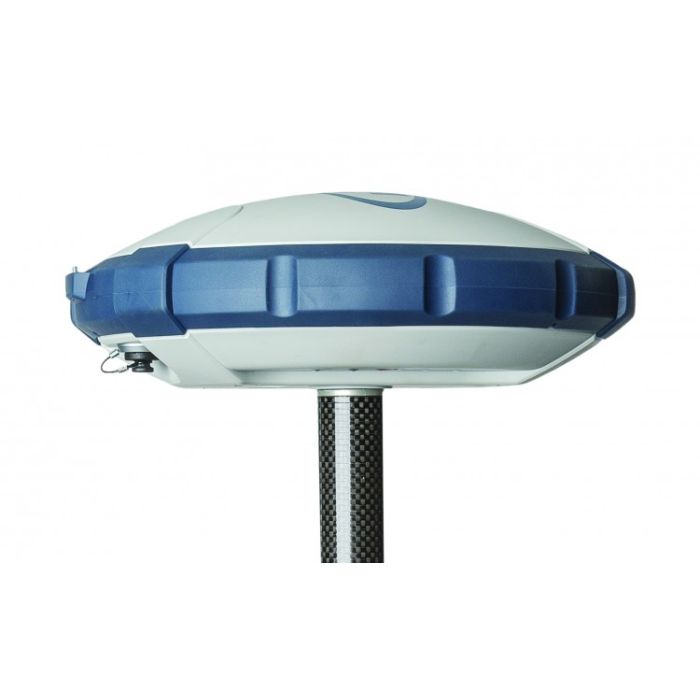
Spectra Geospatial SP60 GPS GNSS Receiver
The Spectra Geospatial SP60 is a new generation GNSS receiver offering a high level of flexibility to cover any demand from GIS all the way up to sophisticated RTK and Trimble RTX™ capable solutions.
The Spectra Geospatial SP60 is a new generation GNSS receiver offering a high level of flexibility to cover any demand from GIS all the way up to sophisticated RTK and Trimble RTX™ capable solutions.
Combining the unique all-signals-tracking and processing Z-Blade GNSS-centric technology and L-band capability for satellitedelivered Trimble RTX correction services, the SP60 receiver provides the most reliable measurements and the highest possible accuracy under any conditions anywhere in the world.
 |
 |
 |
Features & Benefits
- Extended scalability
- Z-Blade GNSS-centric technology
- 240-channel 6G ASIC
- Anti-theft technology
- Long Range Bluetooth
- Trimble CenterPoint® RTX
Truly scalable and versatile
Extremely scalable and versatile, SP60 can respond to any type of GIS or surveying job starting with two GIS configurations, to a simple L1 GPS only post-processing solution, all the way up to dual-frequency GNSS network RTK rover. Also, the L-band capable GNSS antenna delivers Trimble RTX positioning in those places where an RTK network is not available. Finally, optional UHF transmit radio or embedded Long Range Bluetooth enable SP60 receivers to be used as a base and rover system. This extended flexibility allows surveyors to start with a simple solution, and through hardware and firmware upgrades, adapt the SP60 to more complex survey jobs.
Unique 6G GNSS-centric technology
Exclusive Z-Blade processing technology running on a nextgeneration Spectra Geospatial 240-channel 6G ASIC fully utilizes all 6 GNSS systems: GPS, GLONASS, BeiDou, Galileo, QZSS and SBAS. The unique GNSS-centric capability optimally combines GNSS signals without dependency on any specific GNSS system; this allows SP60 to operate in GPS-only, GLONASS-only or BeiDouonly mode if needed. Thanks to this unique GNSS technology, SP60 is optimized for tracking and processing signals even in very challenging environments.
OPEN TO 3RD PARTY CONTROLLERS AND APPLICATIONS
With SP60, consumer devices are no longer limited by their internal GPS and can reach mapping grade or even survey-grade accuracy levels. This solution is also open to any application needing to get an accurate position. The SPace application makes integration immediate and straightforward. With SP60 it is now possible to have accurate positions on an Android consumer smart phone or tablet.
TRIMBLE RTX CAPABLE
Trimble RTX correction services offer a wide range of accuracy requirements ranging from better than 4 cm accuracies, up to submeter accuracies, without the need of an RTK base station or cellular coverage. Trimble RTX is available via both satellite and cellular/IP delivery. The premium service, CenterPoint® RTX is the most accurate satellite-delivered correction service available today. The SP60, empowered with an L-band GNSS antenna, supports the entire suite of Trimble RTX correction services via satellite delivery and is ideal for operating in areas where there is no network available and a local base and rover set-up is not possible. With the SP60 GNSS receiver and a Trimble RTX correction, achieve high-accuracy positioning nearly anywhere in the world.
BUILT-IN LONG RANGE BLUETOOTH
SP60 integrates powerful Long Range Bluetooth capabilities opening new operating modes for surveyors. Now, the Bluetooth wireless communication can be used as an alternative radio link between base and rover over a few hundred meters range making this solution very attractive for small site surveys. Easier and simpler than UHF radio, and without any need for a license, this can be a very efficient way to quickly setup a short range base rover solution.
ANTI-THEFT TECHNOLOGY
Unique anti-theft technology secures SP60 when installed as a field base station in remote or public places and can detect if the product is disturbed, moved or stolen. This technology allows the surveyor to lock the device to a specific location and make it unusable if the device is moved elsewhere. In this case, SP60 will generate an audio alert and block the device from further use. SP60’s anti-theft technology provides surveyors with remote security and peace of mind.
ADVANCED DESIGN
In addition to the cutting-edge L-band capable GNSS antenna, and unique Long Range Bluetooth module, the SP60 GNSS receiver design incorporates a number of innovative ideas and enhancements. It features a rugged, impact-resistant housing, easily withstanding 2m pole drops. Waterproof to IP67 standard, it can handle the toughest outdoor conditions. The patented UHF antenna, set inside the fiberglass rod, extends the range of RTK radio performance and provides protection at the same time. All of these enhancements make the design of SP60 GNSS receiver truly unique and powerful.
THE SPECTRA GEOSPATIAL EXPERIENCE
Survey Pro or FAST Survey field software provides easy-to-use, yet powerful GNSS workflows, letting the surveyor concentrate on getting the job done. The Survey Office Software provides a complete office suite for data processing and Central cloud computing solution offers a simple to use pathway to data exchange and management. When combined with the most advanced and rugged field data collectors from Spectra Geospatial, SP60 is a very powerful and complete solution.
| Firmware Option | Features Added |
|---|---|
| SP60 GNSS L1 | GLONASS, Galileo, Beidou (L1, E1, B1) |
| SP60 L2 | L2 GPS, L2/L3 GLONASS, Galileo E5B, Beidou B2, L2 QZSS |
| SP60 GNSS + L2 | L2 GPS, L1/L2/L3 GLONASS, L2 QZSS, Galileo E1, E5B, Beidou B1, B2 |
| 7/2 | Dithered RTK 7/2: 7cm Horizontal Precision, 2cm Vertical Precision. |
| RTK | Full RTK option |
| 30/30 | 30cm Horizontal Precision, 30cm Vertical Precision |
| Manufacturer | Spectra Geospatial |
|---|